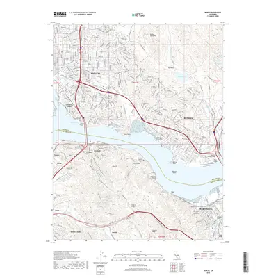
2018 Map of Benicia
USGS Topo · Published 2018About this map
Vallejo and Benicia anchor the northern shoreline of the Carquinez Strait in this 2018 survey, which highlights the industrial and maritime character of the East Bay waterfront. The map traces the rugged southern hills through Franklin Canyon and Big Bull Valley, where the Bay Area Ridge Trail and Sky Trail traverse the ridgelines. Significant local heritage is documented through a dense concentration of cemeteries, including the Military Cem and Saint Vincent Cem near Army Point.
Find a feature on this map
74 named features on this map. Tap any name to fly to it.
Don’t see what you’re looking for? This feature index may not catch every label — zoom into the map to look around manually.
Map Details
Editions of this 2018 Benicia Map
This is the sole edition of this map. No revisions or reprints were ever made.
Other maps of this area

1895 · San Francisco
USGS Topo · 1:62,500

1896 · Carquinez Strait
USGS Topo · 1:62,500

1897 · Concord
USGS Topo · 1:62,500

1898 · Karquines
USGS Topo · 1:62,500

1899 · San Francisco
USGS Topo · 1:62,500

1901 · Karquines
USGS Topo · 1:62,500

1902 · Napa
USGS Topo · 1:125,000

1915 · Concord
USGS Topo · 1:62,500

1915 · San Francisco
USGS Topo · 1:62,500

1916 · Mare Island
USGS Topo · 1:62,500