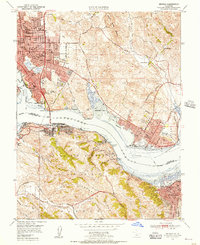
1950 Map of Benicia
USGS Topo · Published 1956About this map
Industrial developments and maritime infrastructure define this mid-century survey of the Carquinez Strait, where the deep-water passage connects the San Pablo and Suisun bays. The landscape is a complex network of company towns and rail hubs, featuring the massive oil tanks at Oleum and the vital ferry and rail connections at Port Costa. To the north, the expanding residential districts of Vallejo and Benicia are mapped alongside institutional landmarks like the California Maritime Academy and the Benicia Airport.
Find a feature on this map
71 named features on this map. Tap any name to fly to it.
Don’t see what you’re looking for? This feature index may not catch every label — zoom into the map to look around manually.
Map Details
Editions of this 1950 Benicia Map
This is the sole edition of this map. No revisions or reprints were ever made.
Other maps of this area

1895 · San Francisco
USGS Topo · 1:62,500

1896 · Carquinez Strait
USGS Topo · 1:62,500

1897 · Concord
USGS Topo · 1:62,500

1898 · Karquines
USGS Topo · 1:62,500

1899 · San Francisco
USGS Topo · 1:62,500

1901 · Karquines
USGS Topo · 1:62,500

1902 · Napa
USGS Topo · 1:125,000

1915 · Concord
USGS Topo · 1:62,500

1915 · San Francisco
USGS Topo · 1:62,500

1916 · Mare Island
USGS Topo · 1:62,500