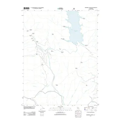
2012 Map of Benmore Canyon
USGS Topo · Published 2012About this map
Indian Valley Reservoir dominates the northeastern landscape of this Lake County region, where the N Fork Cache Cr and its many tributaries carve through a complex system of canyons. The terrain is defined by prominent elevations such as Chalk Mountain and Stony Top, while the southern reaches feature the broad Long Valley. This 2012 survey illustrates a sparse network of forest and access roads, including Wolf Creek Rd and New Long Valley Rd, that navigate the ridges between drainages like Benmore Canyon and Paradise Canyon. The geography here emphasizes the water management and natural drainage patterns vital to the Northern California interior, evidenced by features like Cross Spring and the converging flows of Indian Cr and Middle Cr.
Find a feature on this map
44 named features on this map. Tap any name to fly to it.
Don’t see what you’re looking for? This feature index may not catch every label — zoom into the map to look around manually.
Map Details
Editions of this 2012 Benmore Canyon Map
This is the sole edition of this map. No revisions or reprints were ever made.
Other maps of this area

1920 · Venado
USGS Topo · 1:62,500

1924 · Bartlett Springs
USGS Topo · 1:62,500

1942 · Bartlett Springs
USGS Topo · 1:62,500

1943 · Morgan Valley
USGS Topo · 1:62,500

1944 · Bartlett Springs
USGS Topo · 1:62,500

1944 · Wilbur Springs
USGS Topo · 1:62,500

1944 · Morgan Valley
USGS Topo · 1:62,500

1945 · Lower Lake
USGS Topo · 1:62,500

1947 · Santa Rosa
USGS Topo · 1:250,000

1949 · Santa Rosa
USGS Topo · 1:250,000