
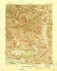
1944 Map of Bartlett Springs
USGS Topo · Published 1944About this map
Bartlett Springs serves as a focal point for this 1940s topography, illustrating the network of mineral springs and remote homesteads throughout the interior ridges of Northern California. The landscape is defined by its deep canyons and named family holdings like the Kowalski Ranch and Butler Ranch, which punctuate the Cache Creek Valley. To the south, the shoreline of Clear Lake reveals the early development of Clearlake Oaks and Glenhaven, including the East Lake Sch and the Cache Creek Rancheria. These lower elevations contrast sharply with the high ridges of Pine Mtn and Chalk Mtn. The survey captures a moment before modern suburban expansion, when small outposts like Allen Springs and Barkerville were connected by narrow routes through the Long Valley and along Sulphur Creek, providing a detailed view for genealogists tracing these specific family settlements.
Find a feature on this map
108 named features on this map. Tap any name to fly to it.
Don’t see what you’re looking for? This feature index may not catch every label — zoom into the map to look around manually.
Map Details
Editions of this 1944 Bartlett Springs Map
2 editions found
Other maps of this area

1920 · Venado
USGS Topo · 1:62,500

1921 · Kelseyville
USGS Topo · 1:62,500

1922 · Hullville
USGS Topo · 1:62,500

1924 · Bartlett Springs
USGS Topo · 1:62,500

1938 · Lakeport
USGS Topo · 1:62,500

1942 · Bartlett Springs
USGS Topo · 1:62,500

1943 · Morgan Valley
USGS Topo · 1:62,500

1943 · Lodoga
USGS Topo · 1:62,500

1943 · Kelseyville
USGS Topo · 1:62,500

1944 · Wilbur Springs
USGS Topo · 1:62,500