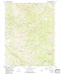
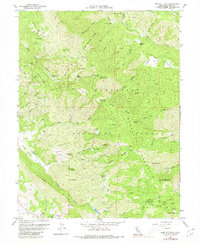
1958 Map of Bartlett Mtn
USGS Topo · Published 1995About this map
Mendocino National Forest dominates this landscape in the late 1950s, characterized by high ridges and the complex drainage systems of the Rice Fork and Cache Creek. This survey reveals the specialized nomenclature of the high country, where features like Telegraph Rock and Lincoln Bluff provide orientation for those navigating the backcountry. The map captures a transition point in the local terrain, where the mountain slopes begin to descend toward the Clear Lake basin, seen here near the settlement of Nice along Lakeview Drive.
Find a feature on this map
69 named features on this map. Tap any name to fly to it.
Don’t see what you’re looking for? This feature index may not catch every label — zoom into the map to look around manually.
Map Details
Editions of this 1958 Bartlett Mtn Map
5 editions found
Other maps of this area

1922 · Hullville
USGS Topo · 1:62,500

1924 · Bartlett Springs
USGS Topo · 1:62,500

1938 · Lakeport
USGS Topo · 1:62,500

1942 · Bartlett Springs
USGS Topo · 1:62,500

1944 · Bartlett Springs
USGS Topo · 1:62,500

1951 · Lake Pillsbury
USGS Topo · 1:62,500

1951 · Lakeport
USGS Topo · 1:62,500

1951 · Stonyford
USGS Topo · 1:62,500

1957 · Ukiah
USGS Topo · 1:250,000

1958 · Clearlake Oaks
USGS Topo · 1:24,000