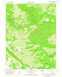
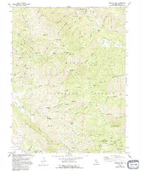
1958 Map of Bartlett Mtn
USGS Topo · Published 1965About this map
Mendocino National Forest defines the character of this mid-century survey, where the ridges and valleys of Lake County are marked by remote outposts and lookout stations. High-elevation vantage points like High Glade Lookout and Pinnacle Rock Lookout overlook a complex drainage system including the North Fork Cache Creek and Middle Creek. To the south, the settlement of Nice sits at the edge of the survey, while the interior is dotted with isolated landmarks such as Crabtree Lodge, Alley Camp, and Wild Bill Place. The landscape is etched with local history found in places like Carter Glades and Telegraph Rock. The network of trails and jeep tracks, such as those through Low Gap and across Ladder Ridge, reveals how this territory was navigated before extensive modern road development reached these higher elevations.
Find a feature on this map
56 named features on this map. Tap any name to fly to it.
Don’t see what you’re looking for? This feature index may not catch every label — zoom into the map to look around manually.
Map Details
Editions of this 1958 Bartlett Mtn Map
5 editions found
Other maps of this area

1922 · Hullville
USGS Topo · 1:62,500

1924 · Bartlett Springs
USGS Topo · 1:62,500

1938 · Lakeport
USGS Topo · 1:62,500

1942 · Bartlett Springs
USGS Topo · 1:62,500

1944 · Bartlett Springs
USGS Topo · 1:62,500

1951 · Lake Pillsbury
USGS Topo · 1:62,500

1951 · Lakeport
USGS Topo · 1:62,500

1951 · Stonyford
USGS Topo · 1:62,500

1957 · Ukiah
USGS Topo · 1:250,000

1958 · Clearlake Oaks
USGS Topo · 1:24,000