
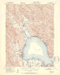
1951 Map of Lakeport
USGS Topo · Published 1953About this map
Clear Lake dominates the central landscape of this 1951 study, with the county seat of Lakeport serving as a primary hub on the western shore. The map reveals a complex social and historical geography, noting the Bloody Island Massacre Historic Marker near Upper Lake, alongside several tribal lands including the Upper Lake Rancheria, Robinson Rancheria, Scotts Valley Rancheria, and Big Valley Rancheria. These designations reflect the enduring indigenous presence in the Clover Creek Valley and surrounding hills.
Find a feature on this map
101 named features on this map. Tap any name to fly to it.
Don’t see what you’re looking for? This feature index may not catch every label — zoom into the map to look around manually.
Map Details
Editions of this 1951 Lakeport Map
2 editions found
Other maps of this area

1920 · Ukiah
USGS Topo · 1:62,500

1921 · Kelseyville
USGS Topo · 1:62,500

1922 · Hullville
USGS Topo · 1:62,500

1924 · Bartlett Springs
USGS Topo · 1:62,500

1938 · Lakeport
USGS Topo · 1:62,500

1938 · Hopland
USGS Topo · 1:62,500

1942 · Bartlett Springs
USGS Topo · 1:62,500

1943 · Pomo
USGS Topo · 1:62,500

1943 · Kelseyville
USGS Topo · 1:62,500

1943 · Hopland
USGS Topo · 1:62,500