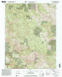
1996 Map of Elk Mountain
USGS Topo · Published 2001About this map
Mendocino National Forest defines this mountain landscape where the boundary of Mendocino and Lake counties meets. The terrain is a network of ridges and drainages, notably Rice Ridge and Skeeter Ridge, which funnel water into the Middle Fork and South Fork tributaries. High points like Elk Mountain and Horse Mountain tower over the canyons, while the Elk Mountain Scenic Viewpoint provides a vista of the surrounding wilderness.
Find a feature on this map
32 named features on this map. Tap any name to fly to it.
Don’t see what you’re looking for? This feature index may not catch every label — zoom into the map to look around manually.
Map Details
Editions of this 1996 Elk Mountain Map
This is the sole edition of this map. No revisions or reprints were ever made.
Other maps of this area

1920 · Ukiah
USGS Topo · 1:62,500

1922 · Hullville
USGS Topo · 1:62,500

1938 · Lakeport
USGS Topo · 1:62,500

1943 · Pomo
USGS Topo · 1:62,500

1944 · Ukiah
USGS Topo · 1:62,500

1951 · Lake Pillsbury
USGS Topo · 1:62,500

1951 · Lakeport
USGS Topo · 1:62,500

1957 · Ukiah
USGS Topo · 1:250,000

1958 · Cow Mountain
USGS Topo · 1:24,000
1958 · Ukiah
USGS Topo · 1:62,500