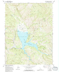
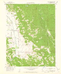
1967 Map of Lake Pillsbury
USGS Topo · Published 1994About this map
Lake Pillsbury serves as the central hub of this Mendocino National Forest terrain, where the impounded waters of the Eel River are managed by Scott Dam. The map documents a specialized landscape of mid-century recreation and aviation, featuring several lakeside facilities like Pogie Point Campground and the Gravelly Valley Airport at the northern edge of the reservoir.
Find a feature on this map
67 named features on this map. Tap any name to fly to it.
Don’t see what you’re looking for? This feature index may not catch every label — zoom into the map to look around manually.
Map Details
Editions of this 1967 Lake Pillsbury Map
4 editions found
Other maps of this area

1922 · Hullville
USGS Topo · 1:62,500

1929 · Eden Valley
USGS Topo · 1:62,500

1943 · Pomo
USGS Topo · 1:62,500

1951 · Lake Pillsbury
USGS Topo · 1:62,500

1952 · Hull Mountain
USGS Topo · 1:62,500

1952 · Eden Valley
USGS Topo · 1:62,500

1957 · Ukiah
USGS Topo · 1:250,000

1960 · Ukiah
USGS Topo · 1:250,000
1960 · Potter Valley
USGS Topo · 1:24,000

1960 · Potter Valley
USGS Topo · 1:62,500