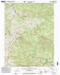
1996 Map of Crockett Peak
USGS Topo · Published 2001About this map
Crockett Peak rises as a central landmark within the Mendocino National Forest, overlooking a landscape defined by the drainage systems of Rice Creek and Cold Creek. This 1990s revision reveals the transition from commercial or ranching activity to protected wilderness, most notably within the Snow Mountain Wilderness. The high ridges are punctuated by summits like Signal Peak and Snow Mountain East, while historical land use is marked by sites such as Marble Cabin (Site) and Milk Ranch. The intricate network of seasonal springs and watercourses, including Hummingbird Creek and Thistle Glade Creek, highlights the topographical complexity that historically dictated movement through the Upper Lake Grindstone District. The boundary between Lake and Colusa counties follows the primary ridgeline, illustrating how natural elevation divides jurisdictional lines in this part of California.
Find a feature on this map
31 named features on this map. Tap any name to fly to it.
Don’t see what you’re looking for? This feature index may not catch every label — zoom into the map to look around manually.
Map Details
Editions of this 1996 Crockett Peak Map
This is the sole edition of this map. No revisions or reprints were ever made.
Other maps of this area

1919 · Elk Creek
USGS Topo · 1:62,500

1922 · Hullville
USGS Topo · 1:62,500

1948 · Elk Creek
USGS Topo · 1:62,500

1951 · Lake Pillsbury
USGS Topo · 1:62,500

1951 · Stonyford
USGS Topo · 1:62,500

1952 · Hull Mountain
USGS Topo · 1:62,500

1957 · Elk Creek
USGS Topo · 1:62,500

1957 · Ukiah
USGS Topo · 1:250,000

1960 · Ukiah
USGS Topo · 1:250,000
1967 · Lake Pillsbury
USGS Topo · 1:24,000