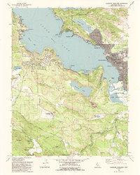
1993 Map of Clearlake Highlands
USGS Topo · Published 1993About this map
Clearlake and its neighboring communities are depicted here during a period of significant late-twentieth-century development along the southeastern shores of Clear Lake. The map illustrates the expansion of Clearlake Highlands and Clearlake Park, where a dense network of residential streets like Austin Ave and Peacock Dr meet the waterfront. This growth is juxtaposed with the preservation of Anderson Marsh State Historical Park, which protects the wetlands and flats near Slater Island.
Find a feature on this map
73 named features on this map. Tap any name to fly to it.
Don’t see what you’re looking for? This feature index may not catch every label — zoom into the map to look around manually.
Map Details
Editions of this 1993 Clearlake Highlands Map
This is the sole edition of this map. No revisions or reprints were ever made.
Other maps of this area

1921 · Kelseyville
USGS Topo · 1:62,500

1924 · Bartlett Springs
USGS Topo · 1:62,500

1938 · Lakeport
USGS Topo · 1:62,500

1942 · Bartlett Springs
USGS Topo · 1:62,500

1943 · Kelseyville
USGS Topo · 1:62,500

1944 · Bartlett Springs
USGS Topo · 1:62,500

1945 · Lower Lake
USGS Topo · 1:62,500

1947 · Santa Rosa
USGS Topo · 1:250,000

1949 · Santa Rosa
USGS Topo · 1:250,000

1951 · Lakeport
USGS Topo · 1:62,500