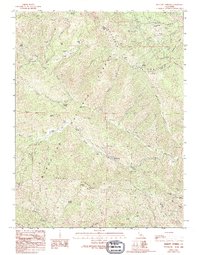
1989 Map of Barlett Springs
USGS Topo · Published 1994About this map
Bartlett Springs stands as a focal point within the Mendocino National Forest, surrounded by a landscape defined by natural springs and isolated forest infrastructure. This late twentieth-century survey reveals a network of remote outposts and recreational spots, from the Pacific Ridge FS Station to the Green Flat Camp. The presence of a small Cem near the springs suggests the long-standing human connection to these mineral waters.
Find a feature on this map
51 named features on this map. Tap any name to fly to it.
Don’t see what you’re looking for? This feature index may not catch every label — zoom into the map to look around manually.
Map Details
Editions of this 1989 Barlett Springs Map
3 editions found
Other maps of this area

1922 · Hullville
USGS Topo · 1:62,500

1924 · Bartlett Springs
USGS Topo · 1:62,500

1938 · Lakeport
USGS Topo · 1:62,500

1942 · Bartlett Springs
USGS Topo · 1:62,500

1944 · Bartlett Springs
USGS Topo · 1:62,500

1951 · Lake Pillsbury
USGS Topo · 1:62,500

1951 · Lakeport
USGS Topo · 1:62,500

1951 · Stonyford
USGS Topo · 1:62,500

1957 · Ukiah
USGS Topo · 1:250,000

1958 · Clearlake Oaks
USGS Topo · 1:24,000