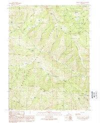
1989 Map of Bartlett Springs
USGS Topo · Published 1989About this map
Bartlett Springs serves as a central landmark in this high-elevation landscape within the Mendocino National Forest. Surveyed through the late 1980s, the map illustrates a network of remote springs and camps, including Addington Springs and Allen Springs, tucked between prominent terrain features like Ruppert Ridge and Mary Ann Ridge. The drainage pattern is dominated by the North Fork Cache Creek and its many tributaries, such as Soap Creek and Ladybug Creek, which carve through the territory along the Colusa and Lake County line.
Find a feature on this map
59 named features on this map. Tap any name to fly to it.
Don’t see what you’re looking for? This feature index may not catch every label — zoom into the map to look around manually.
Map Details
Editions of this 1989 Bartlett Springs Map
3 editions found
Other maps of this area

1922 · Hullville
USGS Topo · 1:62,500

1924 · Bartlett Springs
USGS Topo · 1:62,500

1938 · Lakeport
USGS Topo · 1:62,500

1942 · Bartlett Springs
USGS Topo · 1:62,500

1944 · Bartlett Springs
USGS Topo · 1:62,500

1951 · Lake Pillsbury
USGS Topo · 1:62,500

1951 · Lakeport
USGS Topo · 1:62,500

1951 · Stonyford
USGS Topo · 1:62,500

1957 · Ukiah
USGS Topo · 1:250,000

1958 · Clearlake Oaks
USGS Topo · 1:24,000