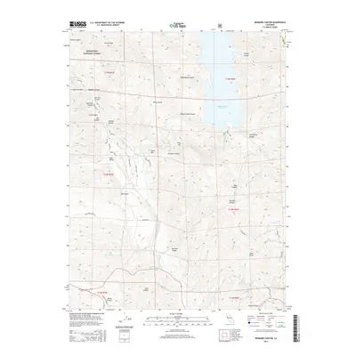
2015 Map of Benmore Canyon
USGS Topo · Published 2015About this map
Mendocino National Forest defines the western edge of this landscape, where the terrain descends into the canyon systems of the Inner Coast Range. The 2015 survey shows a complex network of seasonal drainages and ridges, anchored by the massive Indian Valley Reservoir to the east. The central geography is dominated by Long Valley and the prominent summit of Chalk Mtn, which towers over the intersection of Wolf Cr and Long Valley Cr.
Find a feature on this map
58 named features on this map. Tap any name to fly to it.
Don’t see what you’re looking for? This feature index may not catch every label — zoom into the map to look around manually.
Map Details
Editions of this 2015 Benmore Canyon Map
This is the sole edition of this map. No revisions or reprints were ever made.
Other maps of this area

1920 · Venado
USGS Topo · 1:62,500

1924 · Bartlett Springs
USGS Topo · 1:62,500

1942 · Bartlett Springs
USGS Topo · 1:62,500

1943 · Morgan Valley
USGS Topo · 1:62,500

1944 · Bartlett Springs
USGS Topo · 1:62,500

1944 · Wilbur Springs
USGS Topo · 1:62,500

1944 · Morgan Valley
USGS Topo · 1:62,500

1945 · Lower Lake
USGS Topo · 1:62,500

1947 · Santa Rosa
USGS Topo · 1:250,000

1949 · Santa Rosa
USGS Topo · 1:250,000