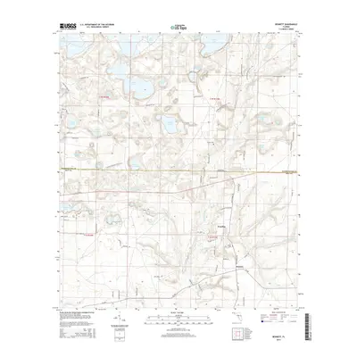
2015 Map of Bennett
USGS Topo · Published 2015About this map
Econfina Creek and its surrounding wetlands dominate this 2015 survey of the Florida panhandle, where the boundary between Washington County and Bay County crosses a landscape of diverse ponds and basins. The small settlements of Econfina and Bennett serve as local anchors in a region defined by complex hydrology, including the wide Swift Creek Swamp and numerous named water bodies like Hammock Lake, Sparkleberry Lake, and the Whitewater Lakes. Local heritage is preserved at the Gainer Cemetery and Porter Cemetery, while modern recreation is represented by the Florida National Scenic Trail as it winds through the woods. The network of rural routes, such as Greenhead Road and Blue Springs Road, connects historic landings like Sweet Gum Landing to the interior, reflecting a long-standing relationship between these North Florida communities and their waterways.
Find a feature on this map
94 named features on this map. Tap any name to fly to it.
Don’t see what you’re looking for? This feature index may not catch every label — zoom into the map to look around manually.
Map Details
Editions of this 2015 Bennett Map
This is the sole edition of this map. No revisions or reprints were ever made.
Other maps of this area

1943 · Southport
USGS Topo · 1:24,000

1944 · Southport
USGS Topo · 1:24,000

1944 · Crystal Lake
USGS Topo · 1:24,000

1944 · Bayhead
USGS Topo · 1:24,000

1944 · Bennett
USGS Topo · 1:24,000

1945 · Youngstown
USGS Topo · 1:31,680

1945 · Bennett
USGS Topo · 1:31,680

1945 · Bayhead
USGS Topo · 1:31,680

1945 · Crystal Lake
USGS Topo · 1:31,680

1945 · Fountain
USGS Topo · 1:31,680