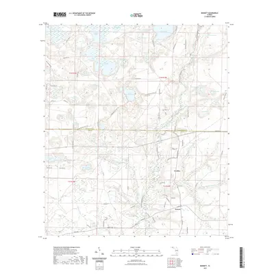
2021 Map of Bennett
USGS Topo · Published 2021About this map
The settlement of Bennett and the community at Econfina are centers of gravity in this landscape where the Florida Panhandle's sandy uplands meet a complex network of freshwater basins. This 2021 survey reveals a territory defined by limestone sinkholes and ponds, including Porter Lake, Hammock Lake, and the expansive Swift Creek Swamp. The southern section shows the clustered development of Pinedale near the intersection of State Hwy 20 and State Hwy 167. Cultural history is anchored by the Porter Cem and Gainer Cem, reflecting long-standing local lineages. Recreational and conservation corridors are prominent, with the Florida National Scenic Trl winding through the terrain and the Econfina Creek Paddling Trl following the waterway that once powered local industry at sites like Mitchell Mill Br.
Find a feature on this map
91 named features on this map. Tap any name to fly to it.
Don’t see what you’re looking for? This feature index may not catch every label — zoom into the map to look around manually.
Map Details
Editions of this 2021 Bennett Map
This is the sole edition of this map. No revisions or reprints were ever made.
Other maps of this area

1943 · Southport
USGS Topo · 1:24,000

1944 · Southport
USGS Topo · 1:24,000

1944 · Crystal Lake
USGS Topo · 1:24,000

1944 · Bayhead
USGS Topo · 1:24,000

1944 · Bennett
USGS Topo · 1:24,000

1945 · Youngstown
USGS Topo · 1:31,680

1945 · Bennett
USGS Topo · 1:31,680

1945 · Bayhead
USGS Topo · 1:31,680

1945 · Crystal Lake
USGS Topo · 1:31,680

1945 · Fountain
USGS Topo · 1:31,680