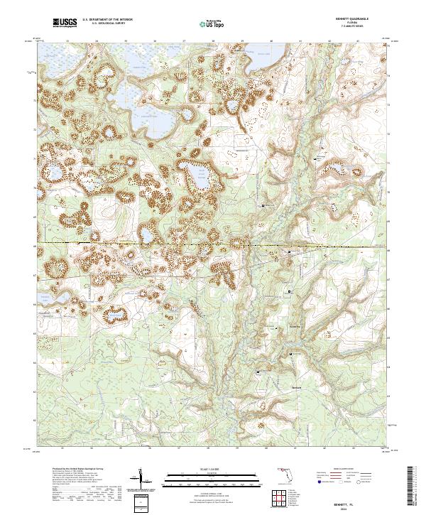
2024 Map of Bennett
USGS Topo · Published 2024About this map
Econfina Creek carves a central path through this landscape, dividing the boundary between Washington and Bay counties. The area is defined by a complex hydrologic network, ranging from the dense Swift Creek Swamp to a multitude of named water bodies such as Hamlin Lake, Gainer Pond, and Wolf Pond. For those tracing local families, the map provides precise locations for several lineage-named landmarks, including McQuagge - Harris Cem, Watts Gainer Cem, and Mashburn Cem. The settlement at Bennett anchors the southern portion of the sheet, while the Florida National Scenic Trl winds through the northern terrain, following the natural contours of the river valley and the limestone-rich topography typical of this Florida Panhandle region.
Find a feature on this map
100 named features on this map. Tap any name to fly to it.
Don’t see what you’re looking for? This feature index may not catch every label — zoom into the map to look around manually.
Map Details
Editions of this 2024 Bennett Map
This is the sole edition of this map. No revisions or reprints were ever made.
Other maps of this area

1943 · Southport
USGS Topo · 1:24,000

1944 · Southport
USGS Topo · 1:24,000

1944 · Crystal Lake
USGS Topo · 1:24,000

1944 · Bayhead
USGS Topo · 1:24,000

1944 · Bennett
USGS Topo · 1:24,000

1945 · Youngstown
USGS Topo · 1:31,680

1945 · Bennett
USGS Topo · 1:31,680

1945 · Bayhead
USGS Topo · 1:31,680

1945 · Crystal Lake
USGS Topo · 1:31,680

1945 · Fountain
USGS Topo · 1:31,680