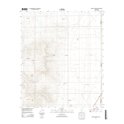
2013 Map of Bennett Mountain
USGS Topo · Published 2013About this map
Saint Nicolas Ranch stands as a primary point of human activity on this high-desert landscape within the Tularosa Valley. The terrain is dominated by the steep eastern front of the San Andres Mountains, where prominent peaks like Bennett Mtn, Goat Mtn, and Black Mtn overlook the arid plains below. Water management in this environment is clearly documented through a series of springs and reservoirs, including San Nicolas Spring, Little San Nicolas Spring, and Red Spring. The presence of Tompson Reservoir and Thompson Reservoir indicates the critical infrastructure needed to sustain ranching or government operations in this area. A network of military access roads, such as Wsmr S Route 272, intersects the landscape, while the southern edge is clipped by the thoroughfares of Us-70 E and Us-70 W.
Find a feature on this map
25 named features on this map. Tap any name to fly to it.
Don’t see what you’re looking for? This feature index may not catch every label — zoom into the map to look around manually.
Map Details
Editions of this 2013 Bennett Mountain Map
This is the sole edition of this map. No revisions or reprints were ever made.
Other maps of this area

1891 · Las Cruces
USGS Topo · 1:125,000

1893 · Las Cruces
USGS Topo · 1:125,000

1916 · Tonuco
USGS Topo · 1:125,000

1916 · Point Of Sands
USGS Topo · 1:125,000

1932 · Tonuco
USGS Topo · 1:125,000

1941 · Organ Peak
USGS Topo · 1:62,500

1943 · Parker Lake
USGS Topo · 1:62,500

1943 · Organ Peak
USGS Topo · 1:62,500

1947 · Lake Lucero
USGS Topo · 1:62,500
1948 · Parker Lake NE
USGS Topo · 1:24,000