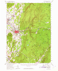
1954 Map of Bennington
USGS Topo · Published 1964About this map
Bennington serves as the industrial and cultural heart of this mid-century landscape, where the Walloomsac River and Roaring Branch converge near the town center. The presence of Bennington College and the towering Battle Monument near Old Bennington highlights the area's educational and commemorative significance. To the east, the terrain rises sharply into the Green Mountain National Forest, marked by the iconic Long Trail traversing Glastenbury Mtn and Bald Mtn.
Find a feature on this map
115 named features on this map. Tap any name to fly to it.
Don’t see what you’re looking for? This feature index may not catch every label — zoom into the map to look around manually.
Map Details
Editions of this 1954 Bennington Map
4 editions found
Other maps of this area

1886 · Greylock
USGS Topo · 1:62,500

1886 · Hawley
USGS Topo · 1:62,500

1888 · Berlin
USGS Topo · 1:62,500

1889 · Wilmington
USGS Topo · 1:62,500

1890 · Hawley
USGS Topo · 1:62,500

1890 · Berlin
USGS Topo · 1:62,500

1891 · Wilmington
USGS Topo · 1:62,500

1891 · Greylock
USGS Topo · 1:62,500

1893 · Greylock
USGS Topo · 1:62,500

1894 · Berlin
USGS Topo · 1:62,500