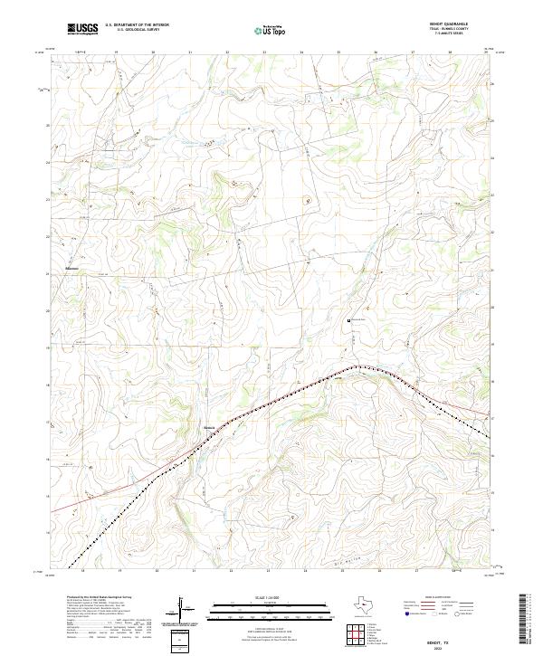
2022 Map of Benoit
USGS Topo · Published 2022About this map
Benoit and Blanton anchor this central Texas landscape, where the drainage of Mustang Cr and its tributaries carve a network through Runnels County. The terrain is defined by seasonal waterways and local landmarks such as Northington Lake and the prominent Dry Hollow to the south. Historically significant for genealogy researchers, the Norwood Cem sits east of the north-south corridor of Co RD 157. The map illustrates a rural Texas economy sustained by a grid of county roads, including FM 382 and Co RD 132, which connect isolated homesteads and ranch lands. Small watercourses like Mud Cr, Hog Cr, and Cow Br trace the natural topography of the region, providing a detailed look at the drainage patterns that have influenced land use and settlement since the earliest ranching days.
Find a feature on this map
30 named features on this map. Tap any name to fly to it.
Don’t see what you’re looking for? This feature index may not catch every label — zoom into the map to look around manually.
Map Details
Editions of this 2022 Benoit Map
This is the sole edition of this map. No revisions or reprints were ever made.
Other maps of this area

1892 · Ballinger
USGS Topo · 1:125,000

1921 · Hatchel
USGS Topo · 1:31,680

1921 · Spur Creek
USGS Topo · 1:31,680

1932 · Voss
USGS Topo · 1:62,500

1932 · Paint Rock
USGS Topo · 1:62,500

1954 · Brownwood
USGS Topo · 1:250,000
1967 · Hatchel
USGS Topo · 1:24,000

1967 · Talpa
USGS Topo · 1:24,000

1967 · Novice West
USGS Topo · 1:24,000
1967 · Little Grape Creek
USGS Topo · 1:24,000