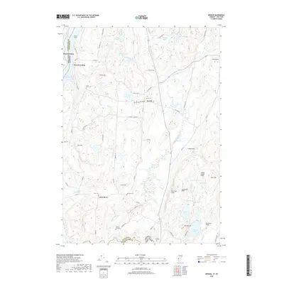
2018 Map of Benson
USGS Topo · Published 2018About this map
Lake Champlain serves as the focal point for this borderland geography, where the state lines of New York and Vermont meet along the water and the Poultney River. The village of Benson and the settlement at West Haven anchor a landscape defined by rolling hills and numerous upland water bodies like Root Pond and Inman Pond. For local historians, the distribution of burial sites is particularly noteworthy, ranging from the Old Cem and Fair View Cem near the town center to the more isolated Hackett Dam Cem and Carver Falls Cem to the south. The drainage of the Hubbardton River and Coggman Cr through the valleys suggests a long-standing agricultural and rural pattern, supported by a network of local routes such as Stage Rd and East Rd.
Find a feature on this map
75 named features on this map. Tap any name to fly to it.
Don’t see what you’re looking for? This feature index may not catch every label — zoom into the map to look around manually.
Map Details
Editions of this 2018 Benson Map
This is the sole edition of this map. No revisions or reprints were ever made.
Other maps of this area

1893 · Whitehall
USGS Topo · 1:62,500

1894 · Ticonderoga
USGS Topo · 1:62,500

1895 · Whitehall
USGS Topo · 1:62,500

1895 · Castleton
USGS Topo · 1:62,500

1896 · Ticonderoga
USGS Topo · 1:62,500

1897 · Castleton
USGS Topo · 1:62,500

1898 · Whitehall
USGS Topo · 1:62,500

1902 · Whitehall
USGS Topo · 1:62,500

1902 · Ticonderoga
USGS Topo · 1:62,500

1902 · Brandon
USGS Topo · 1:62,500