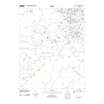
2010 Map of Bent Mountain
USGS Topo · Published 2010About this map
Bent Mountain and the surrounding Roanoke County highlands are depicted here at a point of significant suburban transition. The northeastern quadrant is densely packed with residential developments like Sugar Loaf Estates, Windsor West, and Hidden Valley, contrasting sharply with the steep, wooded slopes of Poor Mountain and Long Ridge to the west. This period shows a landscape where historic rural infrastructure meets modern recreation, anchored by the Blue Ridge Pkwy as it winds south toward Airpoint.
Find a feature on this map
168 named features on this map. Tap any name to fly to it.
Don’t see what you’re looking for? This feature index may not catch every label — zoom into the map to look around manually.
Map Details
Editions of this 2010 Bent Mountain Map
This is the sole edition of this map. No revisions or reprints were ever made.
Other maps of this area

1890 · Roanoke
USGS Topo · 1:125,000

1890 · Christiansburg
USGS Topo · 1:125,000

1891 · Roanoke
USGS Topo · 1:125,000

1929 · Roanoke
USGS Topo · 1:48,000

1929 · Salem
USGS Topo · 1:48,000

1932 · Salem
USGS Topo · 1:62,500

1933 · Roanoke
USGS Topo · 1:62,500

1947 · Roanoke
USGS Topo · 1:250,000

1950 · Elliston
USGS Topo · 1:62,500

1951 · Boones Mill
USGS Topo · 1:62,500