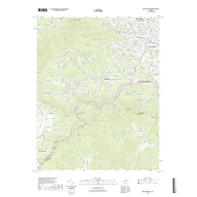
2019 Map of Bent Mountain
USGS Topo · Published 2019About this map
Twelve O'clock Knob and Poor Mtn dominate this 2019 survey of the high-elevation boundary where the Blue Ridge meets the valley floor near Cave Spring. The landscape is defined by its dramatic relief and multiple gap crossings, including Lancaster Gap and Slings Gap, which historically facilitated travel between the interior mountains and the Piedmont. Rural life is grounded in family-named landmarks and historical burial grounds such as Kittinger Cem and Shilling Cem, scattered near the winding route of Bent Mountain Rd.
Find a feature on this map
58 named features on this map. Tap any name to fly to it.
Don’t see what you’re looking for? This feature index may not catch every label — zoom into the map to look around manually.
Map Details
Editions of this 2019 Bent Mountain Map
This is the sole edition of this map. No revisions or reprints were ever made.
Other maps of this area

1890 · Roanoke
USGS Topo · 1:125,000

1890 · Christiansburg
USGS Topo · 1:125,000

1891 · Roanoke
USGS Topo · 1:125,000

1929 · Roanoke
USGS Topo · 1:48,000

1929 · Salem
USGS Topo · 1:48,000

1932 · Salem
USGS Topo · 1:62,500

1933 · Roanoke
USGS Topo · 1:62,500

1947 · Roanoke
USGS Topo · 1:250,000

1950 · Elliston
USGS Topo · 1:62,500

1951 · Boones Mill
USGS Topo · 1:62,500