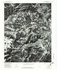
1977 Map of Bent Mountain
USGS Topo · Published 1983About this map
The suburban expansion of Cave Spring meets the high elevations of the Blue Ridge in this late-1970s orthophotograph. While the northern edge shows the developing street grids and residential density of the Roanoke area, the landscape quickly transitions into the steep, wooded terrain of Bent Mountain. This photographic study reveals the stark contrast between the valley's development and the traditional rural patterns maintained along the watercourses. Small settlements like Poages Mill and Naff sit at the crossroads of a complex drainage system, where the Blackwater River and its forks begin their descent. Researchers can trace the clear-cut boundaries of mountain farms and the winding path of Little Back Creek as they negotiate the geography of Simmonds Gap.
Find a feature on this map
15 named features on this map. Tap any name to fly to it.
Don’t see what you’re looking for? This feature index may not catch every label — zoom into the map to look around manually.
Map Details
Editions of this 1977 Bent Mountain Map
This is the sole edition of this map. No revisions or reprints were ever made.
Other maps of this area

1890 · Roanoke
USGS Topo · 1:125,000

1890 · Christiansburg
USGS Topo · 1:125,000

1891 · Roanoke
USGS Topo · 1:125,000

1929 · Roanoke
USGS Topo · 1:48,000

1929 · Salem
USGS Topo · 1:48,000

1932 · Salem
USGS Topo · 1:62,500

1933 · Roanoke
USGS Topo · 1:62,500

1947 · Roanoke
USGS Topo · 1:250,000

1950 · Elliston
USGS Topo · 1:62,500

1951 · Boones Mill
USGS Topo · 1:62,500