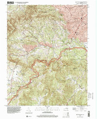
1996 Map of Bent Mountain
USGS Topo · Published 2000About this map
Bent Mountain dominates the southwestern landscape of this survey, where the winding Blue Ridge Parkway traces the crest of the ridge. The topography captures a moment in the mid-1990s where rural crossroads like Poages Mill and Airpoint remain distinct from the suburban expansion near Cave Spring and Starkey. Local family names are preserved through landmarks such as Kittinger Chapel, the Lancaster Cem, and Thompson Grove Ch.
Find a feature on this map
53 named features on this map. Tap any name to fly to it.
Don’t see what you’re looking for? This feature index may not catch every label — zoom into the map to look around manually.
Map Details
Editions of this 1996 Bent Mountain Map
This is the sole edition of this map. No revisions or reprints were ever made.
Other maps of this area

1890 · Roanoke
USGS Topo · 1:125,000

1890 · Christiansburg
USGS Topo · 1:125,000

1891 · Roanoke
USGS Topo · 1:125,000

1929 · Roanoke
USGS Topo · 1:48,000

1929 · Salem
USGS Topo · 1:48,000

1932 · Salem
USGS Topo · 1:62,500

1933 · Roanoke
USGS Topo · 1:62,500

1947 · Roanoke
USGS Topo · 1:250,000

1950 · Elliston
USGS Topo · 1:62,500

1951 · Boones Mill
USGS Topo · 1:62,500