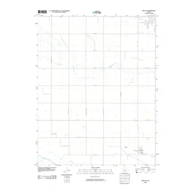
2009 Map of Bentley
USGS Topo · Published 2009About this map
Bentley serves as the primary hub of this rural Kansas landscape, where the town grid is anchored by the Bentley Post Office along W Eagle Rd. The surrounding terrain is defined by the agricultural section lines that grid the prairie, intersected by the meandering path of the Arkansas River in the southwest corner and the drainage network of Kisiwa Creek and its North Branch. The map illustrates a developed network of rural thoroughfares, including named routes like Old Settlers Rd and S Spring Lake Rd, which provide access to scattered farmsteads and agricultural plots. The layout reveals the persistent structure of midwestern land division, showing how local transit and water resources dictated the placement of small-town centers during this era of 21st-century farming.
Find a feature on this map
31 named features on this map. Tap any name to fly to it.
Don’t see what you’re looking for? This feature index may not catch every label — zoom into the map to look around manually.
Map Details
Editions of this 2009 Bentley Map
This is the sole edition of this map. No revisions or reprints were ever made.
Other maps of this area

1889 · Newton
USGS Topo · 1:125,000

1889 · Cheney
USGS Topo · 1:125,000

1889 · Wichita
USGS Topo · 1:125,000

1891 · Hutchinson
USGS Topo · 1:125,000

1891 · Cheney
USGS Topo · 1:125,000

1893 · Hutchinson
USGS Topo · 1:125,000

1894 · Wichita
USGS Topo · 1:125,000

1894 · Newton
USGS Topo · 1:125,000

1901 · Cheney
USGS Topo · 1:125,000

1941 · Maize
USGS Topo · 1:31,680