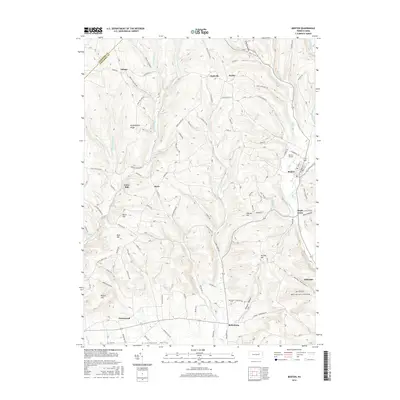
2016 Map of Benton
USGS Topo · Published 2016About this map
Fishing Creek winds through the eastern portion of this Columbia County landscape, anchoring a series of small settlements including Benton and Stillwater. The terrain is defined by a succession of significant rises and hollows, from Huckleberry Ridge in the north to the broad Greenwood Valley in the south. These topographic features often carry family names, such as Kramer Hill and O'Brien Hill, suggesting a long history of local land ownership and lineage.
Find a feature on this map
85 named features on this map. Tap any name to fly to it.
Don’t see what you’re looking for? This feature index may not catch every label — zoom into the map to look around manually.
Map Details
Editions of this 2016 Benton Map
This is the sole edition of this map. No revisions or reprints were ever made.
Other maps of this area

1894 · Bloomsburg
USGS Topo · 1:62,500

1927 · Eagles Mere
USGS Topo · 1:48,000

1932 · Eagle Mere
USGS Topo · 1:62,500

1934 · Laporte
USGS Topo · 1:62,500

1935 · Hughesville
USGS Topo · 1:62,500

1947 · Bloomsburg
USGS Topo · 1:24,000

1947 · Stillwater
USGS Topo · 1:24,000
1947 · Mifflinville
USGS Topo · 1:24,000

1947 · Benton
USGS Topo · 1:31,680
1953 · Bloomsburg
USGS Topo · 1:24,000