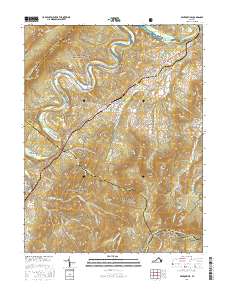
2016 Map of Bentonville
USGS Topo · Published 2016About this map
The South Fork Shenandoah River snakes through the heart of this region, separating the steep eastern ridges of Shenandoah National Park from the heights of Massanutten Mountain to the west. Central to the Page Valley, the settlement of Bentonville serves as a local hub, surrounded by smaller communities such as Limeton, Overall, and Compton. This geography highlights the long-standing importance of river and rail corridors in the valley, with the mountains providing a dramatic backdrop for the Appalachian National Scenic Trail and the high-elevation Skyline Dr. Historically significant hollows and ridges like Thompson Hollow, Gimlet Ridge, and Beecher Ridge segment the landscape, reflecting a pattern of upland land use that borders the George Washington National Forest.
Find a feature on this map
102 named features on this map. Tap any name to fly to it.
Don’t see what you’re looking for? This feature index may not catch every label — zoom into the map to look around manually.
Map Details
Editions of this 2016 Bentonville Map
This is the sole edition of this map. No revisions or reprints were ever made.
Other maps of this area

1893 · Luray
USGS Topo · 1:125,000

1905 · Luray
USGS Topo · 1:125,000

1929 · Stony Man
USGS Topo · 1:48,000

1933 · Stony Man
USGS Topo · 1:62,500

1939 · Front Royal
USGS Topo · 1:48,000

1944 · Front Royal
USGS Topo · 1:62,500

1947 · Strasburg
USGS Topo · 1:62,500

1949 · Charlottesville
USGS Topo · 1:250,000

1950 · Strasburg
USGS Topo · 1:62,500

1956 · Charlottesville
USGS Topo · 1:250,000