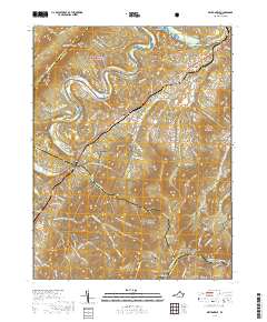
2019 Map of Bentonville
USGS Topo · Published 2019About this map
Bentonville and the surrounding river-valley communities sit at a scenic intersection of transport and terrain where the South Fork Shenandoah River winds through the Page Valley. The Norfolk Southern railroad parallels the river, connecting the settlements of Limeton, Overall, and Compton. This modern survey illustrates the proximity of agricultural bottomlands like Burners Bottom to the preserved wilderness of Shenandoah National Park and the George Washington National Forest.
Find a feature on this map
113 named features on this map. Tap any name to fly to it.
Don’t see what you’re looking for? This feature index may not catch every label — zoom into the map to look around manually.
Map Details
Editions of this 2019 Bentonville Map
This is the sole edition of this map. No revisions or reprints were ever made.
Other maps of this area

1893 · Luray
USGS Topo · 1:125,000

1905 · Luray
USGS Topo · 1:125,000

1929 · Stony Man
USGS Topo · 1:48,000

1933 · Stony Man
USGS Topo · 1:62,500

1939 · Front Royal
USGS Topo · 1:48,000

1944 · Front Royal
USGS Topo · 1:62,500

1947 · Strasburg
USGS Topo · 1:62,500

1949 · Charlottesville
USGS Topo · 1:250,000

1950 · Strasburg
USGS Topo · 1:62,500

1956 · Charlottesville
USGS Topo · 1:250,000