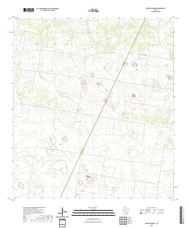
2022 Map of Bentsen Ranch
USGS Topo · Published 2022About this map
The Starr Co Hidalgo Co line serves as the primary orientation point in this remote section of South Texas. This 2022 survey illustrates the sparse, ranch-oriented layout of the brush country, where long-distance roads like La Guajolota Rd and Guasolota Ranch Rd traverse large land tracts. The landscape is dominated by subtle topographic shifts and intermittent drainage patterns characteristic of the Rio Grande Valley hinterlands. Modern infrastructure is represented by the intersection of rural routes including FM 681, CR 4611, and cr4640, providing a clear record of the area's current transportation network and property divisions.
Find a feature on this map
6 named features on this map. Tap any name to fly to it.
Don’t see what you’re looking for? This feature index may not catch every label — zoom into the map to look around manually.
Map Details
Editions of this 2022 Bentsen Ranch Map
This is the sole edition of this map. No revisions or reprints were ever made.
Other maps of this area

1938 · Sal Colorada
USGS Topo · 1:62,500

1939 · La Reforma
USGS Topo · 1:62,500

1940 · Monte Christo
USGS Topo · 1:62,500

1949 · Mc Allen
USGS Topo · 1:250,000

1954 · McAllen
USGS Topo · 1:250,000

1956 · Garcias
USGS Topo · 1:62,500

1957 · Mc Allen
USGS Topo · 1:250,000

1962 · McAllen
USGS Topo · 1:250,000

1963 · Monte Christo
USGS Topo · 1:24,000
1963 · McCook
USGS Topo · 1:24,000