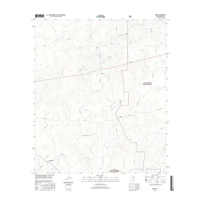
2016 Map of Berea
USGS Topo · Published 2016About this map
Berea and Arbor sit within a landscape defined by the drainage basins of the Davy Crockett National Forest in Houston County. This 2016 survey illustrates the persistent rural network of farm-to-market roads and county lanes that connect small settlements and family holdings. Significant genealogical landmarks are preserved on the sheet, including the English Cem near Wolf Lake and Concord Cem further south. The terrain is deeply etched by a complex creek system, including the prominent White Rock Cr, Dickey Cr, and Hurricane Bayou. To the southwest, Hopewell anchors the map near the intersection of several county roads. The prevalence of named ranches like Pine Shadows Ranch alongside national forest boundaries reflects the modern balance between private agriculture and public timberlands in East Texas.
Find a feature on this map
42 named features on this map. Tap any name to fly to it.
Don’t see what you’re looking for? This feature index may not catch every label — zoom into the map to look around manually.
Map Details
Editions of this 2016 Berea Map
This is the sole edition of this map. No revisions or reprints were ever made.
Other maps of this area

1950 · Crockett
USGS Topo · 1:24,000

1950 · Crockett NE
USGS Topo · 1:24,000

1950 · Ratcliff
USGS Topo · 1:24,000

1951 · Crockett
USGS Topo · 1:24,000

1951 · Kennard
USGS Topo · 1:24,000

1951 · Grapeland
USGS Topo · 1:24,000

1951 · Berea
USGS Topo · 1:24,000

1951 · Crockett NE
USGS Topo · 1:24,000

1951 · Ratcliff
USGS Topo · 1:24,000

1953 · Palestine
USGS Topo · 1:250,000