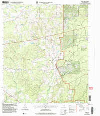
2004 Map of Berea
USGS Topo · Published 2006About this map
Berea serves as a central anchor for this part of Houston County, where agricultural clearings meet the eastern edge of the Davy Crockett National Forest. The map illustrates a rural landscape defined by community centers like Arbor and Hopewell, and the spiritual hubs of Concord Ch, Berea Ch, and Pleasant Grove Ch. The drainage patterns of White Rock Creek and Hurricane Bayou dictate the settlement layout, with local genealogy interests highlighted by the English Cem and several family-named landmarks like the Rains Morgan (Hunt Camp). This 2004 revision reflects a persistent rural character, where small-scale industry like a Gravel Pit exists alongside protected timberlands and winding waterways such as Peachtree Creek and Lynch Creek.
Find a feature on this map
25 named features on this map. Tap any name to fly to it.
Don’t see what you’re looking for? This feature index may not catch every label — zoom into the map to look around manually.
Map Details
Editions of this 2004 Berea Map
This is the sole edition of this map. No revisions or reprints were ever made.
Other maps of this area

1950 · Crockett
USGS Topo · 1:24,000

1950 · Crockett NE
USGS Topo · 1:24,000

1950 · Ratcliff
USGS Topo · 1:24,000

1951 · Crockett
USGS Topo · 1:24,000

1951 · Kennard
USGS Topo · 1:24,000

1951 · Grapeland
USGS Topo · 1:24,000

1951 · Berea
USGS Topo · 1:24,000

1951 · Crockett NE
USGS Topo · 1:24,000

1951 · Ratcliff
USGS Topo · 1:24,000

1953 · Palestine
USGS Topo · 1:250,000