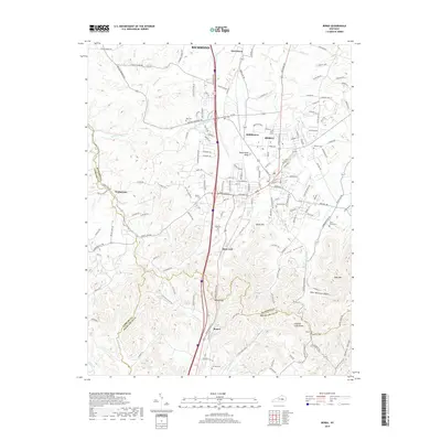
2019 Map of Berea
USGS Topo · Published 2019About this map
Berea and its surrounding communities are documented in this 2019 survey, illustrating the convergence of Madison, Garrard, and Rockcastle counties. The landscape is defined by the significant elevation changes of the Knobs region, featuring prominent landmarks like Dead Horse Knob, Welch Mtn, and Bear Mtn. The town of Boone and the strategic passage at Boone Gap highlight the historical transportation corridor that follows the ridgelines and valleys. Numerous family cemeteries, including Ogg Cem, Todd Cem, and Witt Cem, are preserved across the terrain, offering vital data for genealogical research. The drainage patterns of Paint Lick Cr and Brushy Fork dictate the local geography, while the growth of Middletown and Farristown shows the modern expansion of these historic Kentucky settlements.
Find a feature on this map
158 named features on this map. Tap any name to fly to it.
Don’t see what you’re looking for? This feature index may not catch every label — zoom into the map to look around manually.
Map Details
Editions of this 2019 Berea Map
This is the sole edition of this map. No revisions or reprints were ever made.
Other maps of this area

1892 · Richmond
USGS Topo · 1:125,000

1893 · London
USGS Topo · 1:125,000

1897 · Richmond
USGS Topo · 1:125,000

1897 · London
USGS Topo · 1:125,000

1952 · Berea
USGS Topo · 1:24,000

1952 · Paint Lick
USGS Topo · 1:24,000

1952 · Kirksville
USGS Topo · 1:24,000

1952 · Bighill
USGS Topo · 1:24,000

1952 · Moberly
USGS Topo · 1:24,000

1953 · Richmond South
USGS Topo · 1:24,000