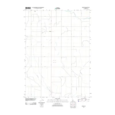
2010 Map of Berger
USGS Topo · Published 2010About this map
Berger is the central hub of this agricultural landscape in Twin Falls County, where a rigid grid of rural roads, including E 3400 N and N 2500 E, dictates the movement of people and commerce. The terrain is defined by the vital irrigation infrastructure necessary for farming in the Idaho desert, most notably the High Line Canal and the High Line North Canal. These engineered waterways contrast with the natural drainage of Desert Creek and the shallow depression of Cedar Draw. Numerous numbered irrigation channels, such as Lateral Number 17 and Lateral 213, branch across the landscape to support local fields. This survey provides a clear view of the rural Idaho countryside in the early 21st century, illustrating how the development of the region remains fundamentally tied to water management and the survey grid system.
Find a feature on this map
23 named features on this map. Tap any name to fly to it.
Don’t see what you’re looking for? This feature index may not catch every label — zoom into the map to look around manually.
Map Details
Editions of this 2010 Berger Map
This is the sole edition of this map. No revisions or reprints were ever made.
Other maps of this area

1950 · Filer
USGS Topo · 1:24,000

1950 · Jerome
USGS Topo · 1:62,500

1951 · Clover
USGS Topo · 1:24,000

1955 · Twin Falls
USGS Topo · 1:250,000

1958 · Twin Falls
USGS Topo · 1:250,000

1964 · Twin Falls
USGS Topo · 1:24,000

1965 · Hollister SW
USGS Topo · 1:24,000

1965 · Hollister
USGS Topo · 1:24,000

1965 · Berger
USGS Topo · 1:24,000

1965 · Berger Butte
USGS Topo · 1:24,000