
1950 Map of Jerome
USGS Topo · Published 1959About this map
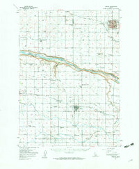
Jerome and Filer serve as the primary hubs in this agricultural landscape of the Magic Valley at mid-century. The Snake River carves a deep canyon across the center of the sheet, dividing Gooding and Jerome counties from Twin Falls County. This river corridor is a center of activity, featuring Niagara Springs, Crystal Springs, and a dedicated Fish Hatchery. The surrounding plains are heavily developed for irrigation, evidenced by the dense network of rural schoolhouses like Appleton Sch, Syringa Sch, and Poplar Hill Sch that once anchored these farming communities.
Find a feature on this map
51 named features on this map. Tap any name to fly to it.
Don’t see what you’re looking for? This feature index may not catch every label — zoom into the map to look around manually.
Map Details
Editions of this 1950 Jerome Map
2 editions found
Other maps of this area

1949 · Thousand Springs
USGS Topo · 1:24,000

1949 · Tuttle
USGS Topo · 1:24,000

1950 · Niagara Springs
USGS Topo · 1:24,000

1950 · Filer
USGS Topo · 1:24,000

1950 · Jerome
USGS Topo · 1:24,000

1951 · Thousand Springs
USGS Topo · 1:24,000

1951 · Tuttle
USGS Topo · 1:24,000

1951 · Clover
USGS Topo · 1:24,000

1954 · Thousand Springs
USGS Topo · 1:24,000

1955 · Twin Falls
USGS Topo · 1:250,000