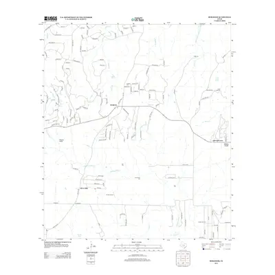
2013 Map of Bergheim
USGS Topo · Published 2013About this map
Bergheim stands as a focal point in this 2013 survey of the Texas Hill Country, characterized by an emerging network of residential developments and rural ranching interests. The landscape is defined by its numerous springs and intermittent waterways, such as Honey Creek Spring and the winding course of Cibolo Cr. The area’s historical depth is visible through several family-named burial grounds, including the Kruckemeyer Cem and Willke Cem, which dot the terrain between growing communities like Silver Hills and Pleasant Valley. Local transportation and utility are represented by the presence of Grosser Airport and the Circle G Rnch. This map documents a period of transition where traditional landholdings and small-scale settlements like Oak Cliff Acres meet the expanding road networks of the modern era.
Find a feature on this map
127 named features on this map. Tap any name to fly to it.
Don’t see what you’re looking for? This feature index may not catch every label — zoom into the map to look around manually.
Map Details
Editions of this 2013 Bergheim Map
This is the sole edition of this map. No revisions or reprints were ever made.
Other maps of this area

1920 · Smithsons Valley
USGS Topo · 1:62,500

1927 · Smithson Valley
USGS Topo · 1:62,500

1929 · Smithson Valley
USGS Topo · 1:62,500

1940 · Smithson Valley
USGS Topo · 1:62,500

1953 · Otis Ridge
USGS Topo · 1:24,000

1953 · Bulverde
USGS Topo · 1:24,000

1953 · Van Raub
USGS Topo · 1:24,000

1954 · San Antonio
USGS Topo · 1:250,000

1957 · Boerne
USGS Topo · 1:62,500

1957 · San Antonio
USGS Topo · 1:250,000