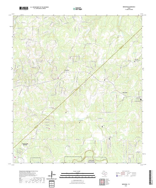
2022 Map of Bergheim
USGS Topo · Published 2022About this map
The hill country landscape at the intersection of Kendall, Comal, and Bexar counties reveals a pattern of modern residential expansion overlapping traditional Texas ranching heritage. Bergheim and Bulverde serve as primary hubs within this terrain, where modern developments like Fair Oaks Ranch sit alongside historic family landmarks. The area is dense with genealogical markers, specifically numerous family and parish burial grounds including Lenz Cem, Saur Cem, and the notable three-part complex of Saint Joseph Honey Creek Cem Number One, Number 2, and Number 3. Hydrological features like Cibolo Cr and Honey Creek Spring define the drainage of this limestone country, while prominent elevations such as Indian Bluff and Mayacama Ridge dictate the winding path of modern thoroughfares like FM 3351 N.
Find a feature on this map
140 named features on this map. Tap any name to fly to it.
Don’t see what you’re looking for? This feature index may not catch every label — zoom into the map to look around manually.
Map Details
Editions of this 2022 Bergheim Map
This is the sole edition of this map. No revisions or reprints were ever made.
Other maps of this area

1920 · Smithsons Valley
USGS Topo · 1:62,500

1927 · Smithson Valley
USGS Topo · 1:62,500

1929 · Smithson Valley
USGS Topo · 1:62,500

1940 · Smithson Valley
USGS Topo · 1:62,500

1953 · Otis Ridge
USGS Topo · 1:24,000

1953 · Bulverde
USGS Topo · 1:24,000

1953 · Van Raub
USGS Topo · 1:24,000

1954 · San Antonio
USGS Topo · 1:250,000

1957 · Boerne
USGS Topo · 1:62,500

1957 · San Antonio
USGS Topo · 1:250,000