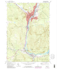
1970 Map of Berlin
USGS Topo · Published 1989About this map
The industrial corridor of the Androscoggin River dominates this survey, tracing the valley between the Mahoosuc Range and the high peaks of the White Mountain National Forest. In Berlin, the dense urban footprint includes a significant collection of parochial institutions such as St Patrick Sch and Notre Dame High Sch, alongside numerous cemeteries like Mt Calvaire Cem and Calvary Cem that overlook the river valley.
Find a feature on this map
79 named features on this map. Tap any name to fly to it.
Don’t see what you’re looking for? This feature index may not catch every label — zoom into the map to look around manually.
Map Details
Editions of this 1970 Berlin Map
4 editions found
Other maps of this area

1893 · Mt. Washington
USGS Topo · 1:62,500

1893 · Gorham
USGS Topo · 1:62,500

1896 · Mt. Washington
USGS Topo · 1:62,500

1896 · Gorham
USGS Topo · 1:62,500

1930 · Milan
USGS Topo · 1:62,500

1930 · Percy
USGS Topo · 1:62,500

1933 · Milan
USGS Topo · 1:62,500

1934 · Percy
USGS Topo · 1:62,500

1934 · Milan
USGS Topo · 1:62,500

1935 · Mt. Washington
USGS Topo · 1:62,500