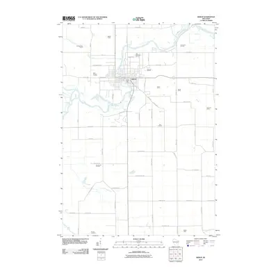
2010 Map of Berlin
USGS Topo · Published 2010About this map
The Fox River meanders through the central and northern sections of this map, defining the historic development of Berlin. Established as a river-based trade center, the city features a concentrated urban core near the Berlin Post Office, with transportation infrastructure radiating outwards. The surrounding landscape is marked by a high density of rural burial grounds, including Saint Stanislaus Cemetery, Oakwood Cemetery, and the Sacramento Cemetery to the northeast, which provide valuable markers for genealogical research in this part of Wisconsin.
Find a feature on this map
59 named features on this map. Tap any name to fly to it.
Don’t see what you’re looking for? This feature index may not catch every label — zoom into the map to look around manually.
Map Details
Editions of this 2010 Berlin Map
This is the sole edition of this map. No revisions or reprints were ever made.
Other maps of this area

1915 · Neshkoro
USGS Topo · 1:48,000

1916 · Ripon
USGS Topo · 1:48,000

1918 · Neshkoro
USGS Topo · 1:62,500

1918 · Ripon
USGS Topo · 1:62,500

1955 · Green Bay
USGS Topo · 1:250,000

1956 · Ripon
USGS Topo · 1:62,500

1957 · Madison
USGS Topo · 1:250,000

1960 · Madison
USGS Topo · 1:250,000

1961 · Poy Sippi
USGS Topo · 1:62,500

1961 · Redgranite
USGS Topo · 1:62,500