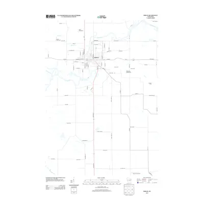
2013 Map of Berlin
USGS Topo · Published 2013About this map
Berlin serves as the focal point of this 2013 survey, where the meandering course of the Fox River defines the town's northern boundary and historical development. The landscape reflects a mix of aviation and transport history, with the Berlin Field Airport to the north and Bennett Field Airport located to the south, alongside the more unusually named Broken Prop Airport. The infrastructure of the era is clearly marked by several rail sidings that hint at local commercial and industrial logistics, including Gelhar Siding, Wendts Siding, and Traugoots Siding. South of the main settlement, the Puchyan River and Town Drain crisscross the rural layout, illustrating the complex water management of this Green Lake County region. Notable industrial landmarks such as the Valley Trail Recycling and Disposal Facility stand alongside established residential thoroughfares like St Stanislaus and E Marquette St.
Find a feature on this map
77 named features on this map. Tap any name to fly to it.
Don’t see what you’re looking for? This feature index may not catch every label — zoom into the map to look around manually.
Map Details
Editions of this 2013 Berlin Map
This is the sole edition of this map. No revisions or reprints were ever made.
Other maps of this area

1915 · Neshkoro
USGS Topo · 1:48,000

1916 · Ripon
USGS Topo · 1:48,000

1918 · Neshkoro
USGS Topo · 1:62,500

1918 · Ripon
USGS Topo · 1:62,500

1955 · Green Bay
USGS Topo · 1:250,000

1956 · Ripon
USGS Topo · 1:62,500

1957 · Madison
USGS Topo · 1:250,000

1960 · Madison
USGS Topo · 1:250,000

1961 · Poy Sippi
USGS Topo · 1:62,500

1961 · Redgranite
USGS Topo · 1:62,500