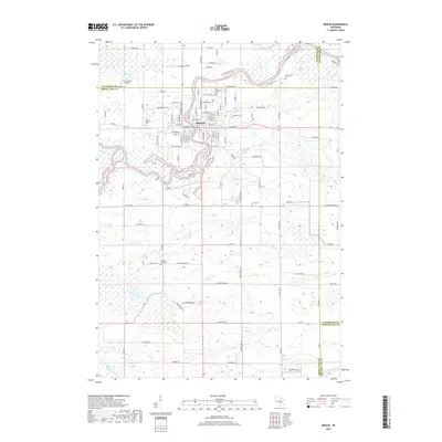
2018 Map of Berlin
USGS Topo · Published 2018About this map
The Fox River snakes through the heart of Berlin, defining the layout of this historic river town at the crossroads of Green Lake, Waushara, and Winnebago counties. The street grid is dense with residential and industrial history, from the banks of the river near Canal St and Broadway St to the surrounding agricultural landscape. Notable for its high density of burial sites, the area contains several historically significant grounds, including Saint Stanislaus Cem, Oakwood Cem, and the Sacramento Cem to the northeast. Beyond the city center, the topography is shaped by the Puchyan River and Barnes Cr, while aviation history is represented by Broken Prop Airport and Berlin Field. The map meticulously records the intersection of local infrastructure and natural waterways, providing a clear picture of the region's development and its preserved historical landmarks.
Find a feature on this map
103 named features on this map. Tap any name to fly to it.
Don’t see what you’re looking for? This feature index may not catch every label — zoom into the map to look around manually.
Map Details
Editions of this 2018 Berlin Map
This is the sole edition of this map. No revisions or reprints were ever made.
Other maps of this area

1915 · Neshkoro
USGS Topo · 1:48,000

1916 · Ripon
USGS Topo · 1:48,000

1918 · Neshkoro
USGS Topo · 1:62,500

1918 · Ripon
USGS Topo · 1:62,500

1955 · Green Bay
USGS Topo · 1:250,000

1956 · Ripon
USGS Topo · 1:62,500

1957 · Madison
USGS Topo · 1:250,000

1960 · Madison
USGS Topo · 1:250,000

1961 · Poy Sippi
USGS Topo · 1:62,500

1961 · Redgranite
USGS Topo · 1:62,500