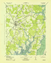
1943 Map of Berlin
USGS Topo · Published 1943About this map
Berlin stands as the central hub of this Worcester County landscape, situated at the intersection of the Baltimore And Eastern and the Pennsylvania (Del MD And Va Branch) railroads. The map captures a wartime coastal environment, evidenced by the presence of Camp Decatur and the strategic orientation of the surrounding necks. To the east, the terrain transitions into the marshy expanses of Hollygrove Swamp and the tidal reaches of Sinepuxent Bay, where the Newbay Ferry provided a critical water crossing near Assateague Island.
Find a feature on this map
77 named features on this map. Tap any name to fly to it.
Don’t see what you’re looking for? This feature index may not catch every label — zoom into the map to look around manually.
Map Details
Editions of this 1943 Berlin Map
2 editions found
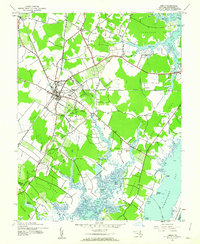
Other maps of this area

1901 · Snow Hill
USGS Topo · 1:62,500

1901 · Green Run
USGS Topo · 1:62,500

1901 · Ocean City
USGS Topo · 1:62,500

1902 · Pittsville
USGS Topo · 1:62,500

1938 · Green Run
USGS Topo · 1:62,500

1942 · Ocean City
USGS Topo · 1:62,500

1942 · Ninepin
USGS Topo · 1:24,000

1942 · Ocean City
USGS Topo · 1:24,000

1942 · Tingles Island
USGS Topo · 1:24,000

1942 · Wesley
USGS Topo · 1:24,000