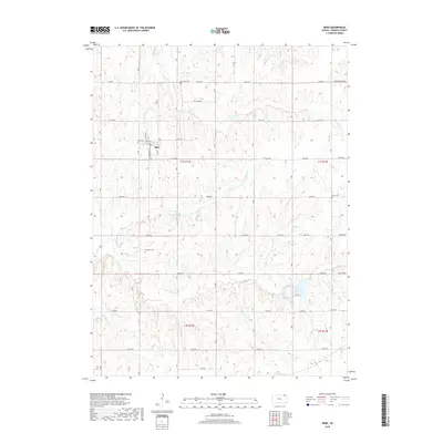
2018 Map of Bern
USGS Topo · Published 2018About this map
Bern stands as the primary community in this portion of Nemaha County, characterized by a regular grid of residential streets including Jilson St and Mathews St. The surrounding landscape is defined by the drainage basins of Fourmile Cr, Wolf Pen Cr, and Deer Cr, which carve a rolling topography through the agricultural heartland. A significant local landmark, Sabetha City Lake, occupies the southeastern corner of the quadrangle, serving as a focal point for water management and recreation in the area. Genealogists and local historians can locate several burial grounds that serve the rural population, including Bern Cem just north of town, Fourmile Cem along Penn Ave, and Williams Cem further south. The map documents the persistent township and range system, with section lines marked by an extensive network of gravel and paved roads like Bern Rd and Church Rd.
Find a feature on this map
31 named features on this map. Tap any name to fly to it.
Don’t see what you’re looking for? This feature index may not catch every label — zoom into the map to look around manually.
Map Details
Editions of this 2018 Bern Map
This is the sole edition of this map. No revisions or reprints were ever made.
Other maps of this area

1888 · Hiawatha
USGS Topo · 1:125,000

1889 · Seneca
USGS Topo · 1:125,000

1894 · Seneca
USGS Topo · 1:125,000

1894 · Hiawatha
USGS Topo · 1:125,000

1916 · Humboldt
USGS Topo · 1:62,500

1950 · Kansas City
USGS Topo · 1:250,000

1954 · Kansas City
USGS Topo · 1:250,000

1955 · Manhattan
USGS Topo · 1:250,000

1955 · Nebraska City
USGS Topo · 1:250,000

1955 · Lincoln
USGS Topo · 1:250,000