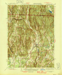
1946 Map of Bernardston
USGS Topo · Published 1946About this map
Bernardston serves as the central hub of this northern Massachusetts landscape, situated where the Falls River and Maine River converge. The Boston and Maine Railroad runs north-south through the valley, passing through Hales Crossing and North Bernardston as it heads toward the Vermont border. The terrain is defined by prominent peaks such as Wildcat Mtn and Bald Mountain, which hem in the agricultural and residential corridors.
Find a feature on this map
66 named features on this map. Tap any name to fly to it.
Don’t see what you’re looking for? This feature index may not catch every label — zoom into the map to look around manually.
Map Details
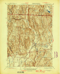
Editions of this 1946 Bernardston Map
2 editions found
Other maps of this area

1887 · Warwick
USGS Topo · 1:62,500

1889 · Warwick
USGS Topo · 1:62,500

1890 · Greenfield
USGS Topo · 1:62,500

1891 · Brattleboro
USGS Topo · 1:62,500

1893 · Brattleboro
USGS Topo · 1:62,500

1894 · Greenfield
USGS Topo · 1:62,500

1894 · Warwick
USGS Topo · 1:62,500

1898 · Keene
USGS Topo · 1:62,500

1932 · Brattleboro
USGS Topo · 1:48,000

1932 · Warwick
USGS Topo · 1:48,000