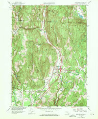
1961 Map of Bernardston
USGS Topo · Published 1971About this map
The Fall River carves a central valley through this northern Massachusetts landscape, serving as a corridor for both the Boston and Maine railroad and the village of Bernardston. This 1961 revision, based on earlier planetable surveys, captures the region's transition from traditional rural patterns to more modern infrastructure. While the high ground is dominated by peaks like Wildcat Mtn and East Mtn, the valley floor shows the influence of the rail line at Hales Crossing and the northern settlement of North Bernardston. To the west, the infrastructure supporting the nearby population centers is visible in the Greenfield Reservoir and Greenfield Filtration Plant, while the eastern edge is defined by the Northfield State Forest. For the genealogist, the map preserves the locations of several burial grounds, including the Old Cem and the Beaver Meadow Cem, alongside family-named heights such as Frizzell Hill and Charles Hill.
Find a feature on this map
60 named features on this map. Tap any name to fly to it.
Don’t see what you’re looking for? This feature index may not catch every label — zoom into the map to look around manually.
Map Details
Editions of this 1961 Bernardston Map
2 editions found
Other maps of this area

1887 · Warwick
USGS Topo · 1:62,500

1889 · Warwick
USGS Topo · 1:62,500

1890 · Greenfield
USGS Topo · 1:62,500

1891 · Brattleboro
USGS Topo · 1:62,500

1893 · Brattleboro
USGS Topo · 1:62,500

1894 · Greenfield
USGS Topo · 1:62,500

1894 · Warwick
USGS Topo · 1:62,500

1898 · Keene
USGS Topo · 1:62,500

1932 · Brattleboro
USGS Topo · 1:48,000

1932 · Warwick
USGS Topo · 1:48,000