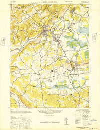
1947 Map of Bernardsville
USGS Topo · Published 1947About this map
The Passaic River and the extensive wetlands of the Great Swamp define the eastern character of this Somerset and Morris County landscape. During this post-war era, the region transitioned from a mill-and-rail economy into a center for institutional and leisure activity. Notable legacy sites include the U.S. Veterans Hospital and the Bonnie Brae Farm For Boys, alongside several recreation grounds like the Schley Polo Field and Somerset Hills Golf Course.
Find a feature on this map
60 named features on this map. Tap any name to fly to it.
Don’t see what you’re looking for? This feature index may not catch every label — zoom into the map to look around manually.
Map Details
Editions of this 1947 Bernardsville Map
This is the sole edition of this map. No revisions or reprints were ever made.
Other maps of this area

1888 · Plainfield
USGS Topo · 1:62,500

1888 · Morristown
USGS Topo · 1:62,500

1888 · Lake Hopatcong
USGS Topo · 1:62,500

1891 · Somerville
USGS Topo · 1:62,500

1893 · Plainfield
USGS Topo · 1:62,500

1893 · Somerville
USGS Topo · 1:62,500

1894 · Morristown
USGS Topo · 1:62,500

1894 · Lake Hopatcong
USGS Topo · 1:62,500

1898 · Lake Hopatcong
USGS Topo · 1:62,500

1898 · Morristown
USGS Topo · 1:62,500
Featured Places
- Bridgewater Township, NJ
- Long Hill Township, NJ
- Bedminster Township, NJ
- Bernardsville, NJ
- Basking Ridge, NJ