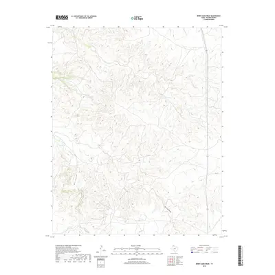
2019 Map of Berry Sand Draw
USGS Topo · Published 2019About this map
Berry Sand Draw defines the deep-cut drainage patterns of this Potter County landscape, where the High Plains drop away into a complex system of creek beds and canyons. The map tracks the winding course of Bonita Creek and its tributary, Box Canyon, as they carve through the local topography. To the north, the terrain is dominated by the branching reaches of Coetas Creek and Chicken Creek, illustrating the erosional forces that have shaped this portion of the Texas Panhandle. In a region where water sources are vital, Pretty Spring remains a significant local landmark. This 2019 survey documents the sparsely settled ranch land where modern infrastructure is represented by FM 1342, cutting across the eastern plains toward the more varied breaks of Alibates Cr at the northern edge.
Find a feature on this map
11 named features on this map. Tap any name to fly to it.
Don’t see what you’re looking for? This feature index may not catch every label — zoom into the map to look around manually.
Map Details
Editions of this 2019 Berry Sand Draw Map
This is the sole edition of this map. No revisions or reprints were ever made.
Other maps of this area

1934 · Cliffside
USGS Topo · 1:62,500

1936 · Fourways
USGS Topo · 1:62,500

1936 · Cliffside
USGS Topo · 1:62,500

1939 · Sanford
USGS Topo · 1:62,500

1953 · Chunky
USGS Topo · 1:24,000

1953 · Alibates Ranch
USGS Topo · 1:24,000

1953 · Pleasant Valley
USGS Topo · 1:24,000

1953 · Deal
USGS Topo · 1:24,000

1953 · Mayer
USGS Topo · 1:24,000

1953 · McDowell Creek
USGS Topo · 1:24,000