
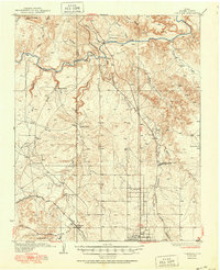
1936 Map of Cliffside
USGS Topo · Published 1936About this map
The Canadian River cuts a deep path through this Panhandle landscape, where the ranching economy of the mid-1930s is mapped in detail. Numerous family-named holdings like the JY Ranch and XL Ranch dominate the northern terrain, while the Fort Worth and Denver City railroad line connects the industrial outposts of Gentry and Cliffside in the south. The presence of the Canadian River Store and several isolated schools, including River Road Sch and Pleasant Valley Sch, reveals the sparse but organized settlement patterns of Potter County during this era.
Find a feature on this map
34 named features on this map. Tap any name to fly to it.
Don’t see what you’re looking for? This feature index may not catch every label — zoom into the map to look around manually.
Map Details
Editions of this 1936 Cliffside Map
2 editions found
Other maps of this area

1934 · Ady
USGS Topo · 1:62,500

1934 · Cliffside
USGS Topo · 1:62,500

1936 · Fourways
USGS Topo · 1:62,500

1936 · Ady
USGS Topo · 1:62,500

1939 · Sanford
USGS Topo · 1:62,500

1953 · Chunky
USGS Topo · 1:24,000

1953 · Marsh
USGS Topo · 1:24,000

1953 · Puente
USGS Topo · 1:24,000

1953 · Alibates Ranch
USGS Topo · 1:24,000

1953 · Pleasant Valley
USGS Topo · 1:24,000