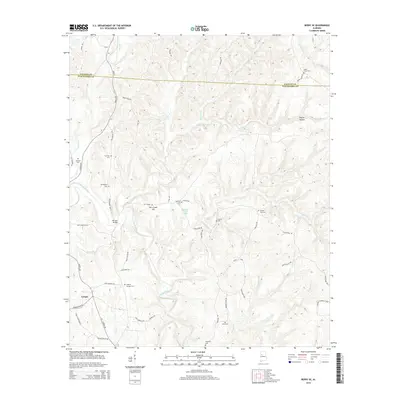
2014 Map of Berry SE
USGS Topo · Published 2014About this map
Gorgas sits at the southwestern edge of this survey, a landscape defined by the winding course of the North River and its numerous tributaries. The terrain is a complex network of ridges and hollows, such as Poplar Hollow, where small family cemeteries and rural churches anchor the local geography. Significant local history is preserved in the naming of sites like Bethlehem Church Spring and the Wittson Bridge, which crosses the river near the junction of Willingham Rd and New Lexington Rd. The map reveals a dense web of local roads and loops, including Utley Loop and Paul Jones Loop, that connect disparate homesteads and burial grounds. This documentation of the Fayette and Tuscaloosa county line provides a clear picture of the area's rural settlement patterns, marked by landmarks like Tyro Creek Hill and the many community cemeteries that serve as vital links to the region's genealogical past.
Find a feature on this map
60 named features on this map. Tap any name to fly to it.
Don’t see what you’re looking for? This feature index may not catch every label — zoom into the map to look around manually.
Map Details
Editions of this 2014 Berry SE Map
This is the sole edition of this map. No revisions or reprints were ever made.
Other maps of this area

1893 · Jasper
USGS Topo · 1:125,000

1899 · Brookwood
USGS Topo · 1:125,000

1926 · Samantha
USGS Topo · 1:48,000

1928 · Samantha
USGS Topo · 1:62,500

1929 · Searles
USGS Topo · 1:48,000

1934 · Searles
USGS Topo · 1:62,500

1949 · Oakman
USGS Topo · 1:24,000

1949 · Wiley
USGS Topo · 1:24,000

1951 · Oakman
USGS Topo · 1:24,000

1951 · Wiley
USGS Topo · 1:24,000