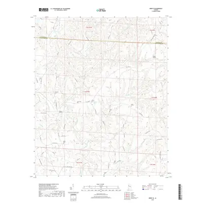
2018 Map of Berry SE
USGS Topo · Published 2018About this map
The North River carves a winding path through this corner of the Alabama back country, where the borders of Fayette and Tuscaloosa Counties meet. This landscape is defined by its deep hollows and creek networks, including Cedar Cr and Tyro Cr, which have long shaped the placement of local roads and family settlements. High ground is marked by features like Tyro Creek Hill, while the valleys are threaded with a dense collection of historic burial grounds that speak to the area's deep-rooted community history. Many of these sites, such as Union Grove Cem and Sulphur Springs Cem, are located near crossroads or along older ridge routes like Upper Ridge Rd. The presence of Bethlehem Church near the center of the survey area suggests a long-standing local hub for the surrounding rural families and farmers who navigated this dissected terrain.
Find a feature on this map
69 named features on this map. Tap any name to fly to it.
Don’t see what you’re looking for? This feature index may not catch every label — zoom into the map to look around manually.
Map Details
Editions of this 2018 Berry SE Map
This is the sole edition of this map. No revisions or reprints were ever made.
Other maps of this area

1893 · Jasper
USGS Topo · 1:125,000

1899 · Brookwood
USGS Topo · 1:125,000

1926 · Samantha
USGS Topo · 1:48,000

1928 · Samantha
USGS Topo · 1:62,500

1929 · Searles
USGS Topo · 1:48,000

1934 · Searles
USGS Topo · 1:62,500

1949 · Oakman
USGS Topo · 1:24,000

1949 · Wiley
USGS Topo · 1:24,000

1951 · Oakman
USGS Topo · 1:24,000

1951 · Wiley
USGS Topo · 1:24,000